A hike around Ma Wan Island - Part 1
My recent post post about the history of Ma Wan History of Ma Wan inspired a friend of mine who came from overseas in Hong Kong, to take a big hike around Ma Wan Island.
I took a bunch of photos during our walk, some of which came out really well, and if I do say do myself, some are actually quite artistic. I am going to post these up in various parts on this blog, along with my comments.
I hope my photos will encourage people to come over and spend a day hiking on Ma Wan. There are really some quite spectacular and unique things to see!
 |
| Hiking up Ma Wan Island |
 |
| Park Island Estate |
You can see here the view from the Ma Wan peak, over the Noah Ark and then the Park Island Estate in the distance.
 |
| View from Ma Wan Island |
 |
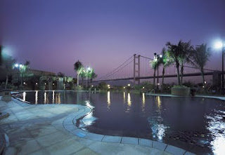
| Tsing Ma Bridge |
This is the view of the Tsing Ma Bridge as we got up the higher on Ma Wan. Here is another shot.
 |
| Photo of Tsing Ma Bridge |
The above two photos are of the bridge is it connects towards Hong Kong. From where I took this photo, you can also see the other part of the bridge that connects towards Hong Kong airport. A photo of that view below.
 |
| Tsing Ma bridge towards Hong Kong airport |
 |
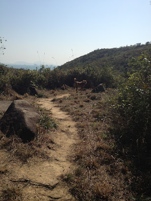
| Ma Wan hiking trail |
The path then went further up the mountain. What I like is that this is a "natural path". Not concreted over, like they have "helpfully done", even on places like Lamma Island. As you get a bit higher, you get a view like this:
 |
| View from Ma Wan Island towards Hong Kong Island |
In "A hike around Ma Wan Island - Part 2" I will continue with photos from the very top, and the walk down past a local graveyard towards the beach on the Southern part of Ma Wan closest to Hong Kong Island.
PS - for a previous post on a similar hike I did some time ago see: Hiking in Hong Kong (Ma Wan).
PS - for a previous post on a similar hike I did some time ago see: Hiking in Hong Kong (Ma Wan).


Excellent photos on a bright day. Why have they blocked off the path cutting off accessibility? It should on public land?
ReplyDeleteI just recently arrived in HK and staying in Park Island. I walked around the island and can't seem to find any trails good for hiking. Where should I start? Is there a place on the island to rent bicycles?
ReplyDeleteI just recently arrived in HK and staying in Park Island. I walked around the island a few times but can't find any trails to hike. Where should I start? Are there any bicycle rentals on the island?
ReplyDeleteFantastic views!
ReplyDeletecant wait to try it. tx for posting
ReplyDeleteOn the hiking trail at some point instead of going up you can turn left which brings to a small beach (there is an old well on the way)
ReplyDeletej
shame they will develop the other side of ma wan at some point. hopefully the don't overdevelop it.
ReplyDelete